Course Outline
Introduction to 3D Design and Photogrammetry for Government
- Overview of fundamental 3D design concepts
- Significance and practical applications of photogrammetry in government operations
Getting Started with Rhinoceros 6 for Government
- Familiarization with the Rhino 6 interface and essential tools
- Basic navigation techniques and object manipulation
- Creation of simple 3D shapes for government projects
Introduction to Agisoft Metashape for Government
- Overview of the PhotoScan/Metashape interface for government use
- Foundational principles of photogrammetry and data acquisition for public sector applications
- Preparation of photographs for processing in government projects
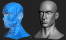
NURBS Modeling Techniques for Government
- Understanding NURBS (Non-Uniform Rational B-Splines) for precise modeling
- Creating and editing complex surfaces and curves for detailed government designs
- Modeling a product design to meet government specifications
Precision and Accuracy in Rhino 6 for Government
- Utilizing snapping, grid, and coordinate systems for accurate modeling
- Applying Boolean operations and transformations for complex designs
- Architectural modeling to support government infrastructure projects
Rendering and Visualization for Government
- Introduction to rendering concepts for government presentations
- Setting up lights, materials, and environments for realistic visualizations
- Exporting high-quality renders for government reports and publications
Photogrammetric Workflow for Government
- Importing and aligning photos for government projects
- Building dense point clouds and 3D meshes to support public sector applications
- Texturing and refining models for detailed government presentations
Georeferencing and Scaling for Government
- Introduction to georeferencing concepts for government mapping and surveying
- Applying scale bars and ground control points for precise measurements
- Exporting georeferenced models and orthophotos for government use
Advanced Processing Techniques for Government
- Optimizing photo alignment and dense cloud settings for enhanced accuracy
- Using masks and manual editing tools to refine photogrammetric data
- Reconstructing landscapes from photos for government environmental assessments
Importing and Exporting Models for Government
- Exporting models from Metashape to Rhino for integrated use in government projects
- Cleaning and refining imported models in Rhino to meet government standards
- Integrating photogrammetric models into CAD designs for comprehensive government solutions
Enhancing Photogrammetric Models in Rhino for Government
- Adding details and features to photogrammetric models to support government initiatives
- Applying Rhino’s tools to improve the accuracy and aesthetics of models for government use
- Enhancing an archaeological site model to support cultural resource management
Summary and Next Steps for Government
Requirements
- An understanding of three-dimensional concepts
Audience for government
- Designers
- Engineers
- Geospatial professionals
Testimonials (2)
The practices and the fact that you can share your screen for guidance from the trainer
Ramon Vann Cleff - DOST - Advanced Science and Technology Institute
Course - SolidWorks
the point that Huba took the time to sit with me as the lesser knowledgeable of the application and go through each part and explain where i had gone wrong and how to correct the issue