Online or onsite, instructor-led live Geographic Information System (GIS) training courses demonstrate through interactive hands-on practice how to use a GIS to capture, store, manipulate, analyze, manage, and present spatial or geographic data for government.
GIS training is available as "online live training" or "onsite live training". Online live training (also known as "remote live training") is conducted via an interactive, remote desktop. Onsite live training can be conducted locally on customer premises in Indiana or in Govtra corporate training centers in Indiana.
Govtra -- Your Local Training Provider for Government
Indianapolis, IN - Lockerbie Marketplace
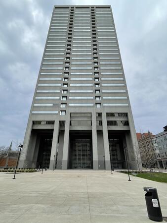
333 N. Alabama Street Suite 350, Indianapolis, United States, 46204
Regus at Lockerbie Marketplace is centrally located in downtown Indianapolis and easily accessible by car, with public parking available along North Alabama Street and in nearby garages. Visitors flying into Indianapolis International Airport (IND) can reach the venue in approximately 20 to 25 minutes via taxi or rideshare, following I‑70 E and exiting onto New York Street toward downtown. For public transit users, IndyGo routes serving the Massachusetts Avenue and Chatham Arch districts stop within a few blocks, making the location convenient for those traveling from other parts of the city.
Fort Wayne, IN - Regus – Power Center
110 E Wayne St floor 12, Fort Wayne, United States, 46802
The venue is conveniently located in downtown Fort Wayne, easily accessible by car via Interstate 69 through either the South Clinton Street or Apple Street exits, which lead directly into the Wayne Street corridor. Visitors will find nearby parking garages as well as metered street parking options. For those arriving by air, the venue is approximately 13 miles northeast of Fort Wayne International Airport (FWA), with a taxi or rideshare ride taking about 20 minutes via I‑69 and Jefferson Boulevard. Public transit is also available: Citilink buses serve downtown with stops just a few blocks away from the venue, near the intersection of Wayne and Clinton Streets.
Indianapolis, IN - Regus – Parkwood Crossing Center
450 E 96th St #500, Indianapolis, United States, 46240
This venue is conveniently accessed by car via the I‑465 beltway, exiting north onto Keystone Avenue before turning onto E 96th Street; ample parking is available in the adjacent surface and garage lots. For those arriving by air, the Indianapolis International Airport (IND) is approximately 17 miles away, with taxis or rideshares taking roughly 25–30 minutes via I‑465 and Keystone Avenue. Public transit is available via IndyGo routes 19 and 120, which serve the 96th Street corridor; the bus stop at Parkwood Crossing is only a short walk from the building.
ArcGIS Professional Plus is an advanced version of ArcGIS Pro, designed to provide enhanced capabilities for geospatial data analysis, 3D modeling, automation, and enterprise collaboration.
This instructor-led, live training (available online or on-site) is tailored for intermediate-level GIS professionals who aim to deepen their expertise in spatial data analysis, automation, and sharing using the tools provided by ArcGIS Professional Plus.
By the end of this training, participants will be able to:
- Utilize ArcGIS Pro Plus tools for advanced data visualization and analysis.
- Develop 2D and 3D maps with sophisticated symbology and geoprocessing techniques.
- Automate workflows through the use of ModelBuilder and Python scripting.
- Integrate ArcGIS with external data services and enterprise systems.
**Format of the Course**
- Interactive lectures and discussions.
- Extensive exercises and practice sessions.
- Hands-on implementation in a live-lab environment.
**Course Customization Options for Government**
- To request a customized training program tailored to specific needs, please contact us to arrange.
This instructor-led, live training in [location] (online or onsite) is designed for government GIS professionals and analysts at all levels who wish to effectively use ArcGIS for data visualization, spatial analysis, and geospatial project management.
By the end of this training, participants will be able to:
- Navigate and utilize ArcGIS tools for geospatial data management.
- Create and customize maps with layers and attributes.
- Perform advanced spatial analysis and geoprocessing tasks.
- Automate workflows using ModelBuilder and Python for government applications.
This instructor-led, live training in [location] (online or onsite) is designed for advanced-level GIS professionals who wish to utilize ArcGIS Pro to enhance their spatial analysis capabilities, conduct comprehensive geostatistical analysis, and apply advanced 3D modeling techniques for more effective decision-making and problem-solving in real-world scenarios.
By the end of this training, participants will be able to:
- Develop advanced skills in spatial analysis techniques using ArcGIS Pro.
- Utilize Python scripting for automation and complex data processing tasks.
- Apply spatial modeling to address real-world challenges.
- Conduct geostatistical analysis for advanced data interpretation.
- Integrate external data sources and leverage 3D spatial data analysis, ensuring alignment with the specific needs of public sector workflows for government.
This instructor-led, live training in Indiana (online or onsite) is designed for beginner-level IT support personnel who aim to provide robust support for ArcGIS Enterprise, effectively addressing any anomalies or failures.
By the end of this training, participants will be able to:
- Understand the architecture and components of ArcGIS Enterprise.
- Learn how to install, configure, and manage ArcGIS Enterprise.
- Acquire skills in troubleshooting and resolving common issues.
- Develop proficiency in monitoring and maintaining ArcGIS Enterprise environments.
- Master techniques for backup, recovery, and performance optimization, ensuring reliable service delivery for government operations.
This instructor-led, live training in [location] (online or onsite) is designed for government professionals at the beginner level who wish to learn the fundamental concepts and tools of ArcGIS.
By the end of this training, participants will be able to:
- Understand the basic principles of Geographic Information Systems (GIS) and spatial data.
- Navigate the ArcGIS interface effectively.
- Create and manage spatial datasets.
- Conduct basic spatial analysis.
- Produce maps and visualizations for government use.
This instructor-led, live training (online or onsite) is designed for government earth sciences and engineering professionals at the beginner level who wish to utilize Python for geospatial analysis in both ArcGIS and QGIS environments.
By the end of this training, participants will be able to:
Master Python syntax and control structures to efficiently execute geospatial tasks.
Utilize Pandas, Numpy, and Matplotlib for data analysis and visualization in GIS applications.
Manage and analyze vector data using Geopandas, Arcpy, and PyQGIS libraries.
Automate geospatial processes and workflows through Python scripting in ArcGIS and QGIS.
Create custom Python-based geoprocessing tools for ArcGIS and QGIS to enhance task efficiency.
This instructor-led, live training in Indiana (online or onsite) is aimed at intermediate-level environmental scientists and archaeologists who wish to learn how to use ArcMap in ArcGIS for government for collecting, organizing, managing, and analyzing geographic information.
By the end of this training, participants will be able to:
Understand the fundamentals of ArcMap and ArcGIS for government.
Collect, organize, manage, and analyze geographic information related to social and archaeological elements.
This instructor-led, live training in [location] (online or onsite) is designed for intermediate-level geographers who wish to enhance their expertise in spatial analysis, data management, and GIS applications for government.
By the end of this training, participants will be able to:
- Apply advanced spatial analysis techniques to address complex geographical challenges.
- Manage large spatial databases and conduct thorough data quality control.
- Create dynamic and interactive maps and visualizations for a variety of applications.
- Utilize programming and automation to optimize GIS workflows for government.
A Geographic Information System (GIS) is a system designed to capture, store, manipulate, analyze, manage, and present spatial or geographic data. The term GIS is sometimes used interchangeably with Geographic Information Science (GIScience), which refers to the academic discipline that studies these systems and falls under the broader field of geoinformatics.
The integration of Python into GIS has significantly expanded over the past two decades, particularly following the release of Python 2.0 in 2000. This version introduced numerous programming features that made the language more accessible and easier to deploy. Since then, Python has become a prevalent tool not only within commercial GIS platforms, such as those provided by Esri, but also in open-source environments like QGIS and GRASS. Today, Python is widely recognized as the most commonly used programming language among GIS users and developers.
This program for government focuses on the application of Python and its advanced libraries, including GeoPandas, PySAL, Bokeh, and OSMnx, to implement customized GIS features. The curriculum also includes introductory modules on the ArcGIS API and the QGIS toolbox, providing a comprehensive overview of modern GIS tools and techniques.
This instructor-led, live training (conducted online or onsite) is designed for field ecologists and conservation managers who aim to develop spatial data projects using ArcGIS.
By the end of this training, participants will be able to:
- Generate visualizations from spatial data.
- Perform geostatistical analyses on real-world datasets.
- Execute spatial data analysis, data processing, and mapping with ArcGIS.
- Analyze spatial data for various projects in ArcGIS, ensuring alignment with public sector workflows and governance standards for government.
This instructor-led, live training in Indiana (online or onsite) is aimed at GIS analysts who wish to automate repetitive tasks in GIS processes for government.
By the end of this training, participants will be able to:
- Build GIS applications using Python and ArcGIS tools.
- Develop with the ArcGIS package ArcPy, utilizing Python.
- Apply the ArcGIS modules for map automation by leveraging object classes in Python.
This instructor-led, live training in Indiana (online or onsite) is aimed at developers who wish to enhance their website or web application by adding geo-location functionality through Google Maps for government use.
By the end of this training, participants will be able to:
Embed a map into a new or existing website or web application for government purposes.
Display live data that synchronizes with current location.
Create a mashup that includes Google Maps for enhanced public sector applications.
Apply best practices in CSS and JavaScript coding to ensure robust and secure web solutions for government.
Create a custom map tailored for specific government applications.
This instructor-led, live online training is designed for advanced learners who wish to develop skills in managing large-scale spatial databases using PostGIS and QGIS.
**Format of the Course**
- Interactive lectures and discussions.
- Extensive exercises and practice sessions.
- Hands-on implementation in a live-lab environment.
**Course Customization Options**
- To request a customized training for government or other specific needs, please contact us to arrange.
A geographic information system (GIS) is designed to capture, store, manipulate, analyze, manage, and present spatial or geographic data. The term GIS is sometimes used interchangeably with geographic information science (GIScience), which refers to the academic discipline that studies these systems and is a significant domain within the broader field of geoinformatics.
QGIS functions as geographic information system (GIS) software, enabling users to analyze and edit spatial information, as well as compose and export graphical maps. QGIS supports both raster and vector layers; vector data can be stored as point, line, or polygon features. The software accommodates multiple formats of raster images and can georeference these images. In summary, QGIS allows users to create, edit, visualize, analyze, and publish geospatial information on Windows, Mac, Linux, and BSD.
This program, in its first phase, introduces the QGIS interface for general usage. In the second phase, it covers PyQGIS—the Python libraries of QGIS that enable the integration of GIS functionalities into Python code or applications. This allows users to develop their own Python plugins around specific GIS functionalities, enhancing capabilities for government and other sectors.
A Geographic Information System (GIS) is designed to capture, store, manipulate, analyze, manage, and present spatial or geographic data. The term GIS is also used to refer to the academic discipline of geographic information science (GIScience), which studies these systems and is a significant domain within the broader field of geoinformatics.
This instructor-led, live training (online) is intended for government employees at a beginner level who wish to gain knowledge on GIS concepts and practical skills for using QGIS.
**Format of the Course**
- Interactive lecture and discussion.
- Extensive exercises and practice sessions.
- Hands-on implementation in a live-lab environment.
**Course Customization Options**
- To request a customized training for government, please contact us to arrange.
This instructor-led, live online training at an intermediate level is designed to teach participants how to work with satellite imagery and perform image classification using QGIS.
**Format of the Course**
- Interactive lecture and discussion.
- Extensive exercises and practice sessions.
- Hands-on implementation in a live-lab environment.
**Course Customization Options for Government**
To request a customized training for this course, please contact us to arrange.
Read more...
Last Updated:
Testimonials (4)
Hands-on examples allowed us to get an actual feel for how the program works. Good explanations and integration of theoretical concepts and how they relate to practical applications.
Ian - Archeoworks Inc.
Course - ArcGIS Fundamentals
All the topics which he covered including examples. And also explained how they are helpful in our daily job.
madduri madduri - Boskalis Singapore Pte Ltd
Course - QGIS for Geographic Information System
I really enjoyed the training. I found all modules to be applicable to problems that I am trying to solve at work. The integration of the training with jupyter notebooks was really impressive.
Mark Firmin - Environment and Climate Change Canada
Course - Python for Geographic Information System (GIS)
The thing I liked the most about the training was the organization and the location
Hamid Tuama - Ability with Innovation General Contracting (DMCC Branch)
Online GIS training in Indiana, GIS training courses in Indiana, Weekend Geographic Information System courses in Indiana, Evening GIS (Geographic Information System) training in Indiana, GIS (Geographic Information System) instructor-led in Indiana, GIS classes in Indiana, GIS on-site in Indiana, GIS boot camp in Indiana, Evening GIS (Geographic Information System) courses in Indiana, GIS (Geographic Information System) one on one training in Indiana, GIS (Geographic Information System) private courses in Indiana, GIS instructor in Indiana, GIS coaching in Indiana, Weekend GIS training in Indiana, Geographic Information System instructor-led in Indiana, Online GIS training in Indiana, Geographic Information System trainer in Indiana