Instructor-led Data Analysis training courses, available both online and onsite, provide comprehensive instruction through discussion and hands-on practice. These courses cover the programming languages and methodologies essential for performing data analysis.
Data Analysis training can be conducted as "online live training" or "onsite live training." Online live training, also known as "remote live training," is facilitated through an interactive remote desktop environment. Onsite live training can be arranged at customer premises in Florida or at NobleProg corporate training centers in Florida.
NobleProg serves as a trusted provider of local training solutions for government and private sector organizations.
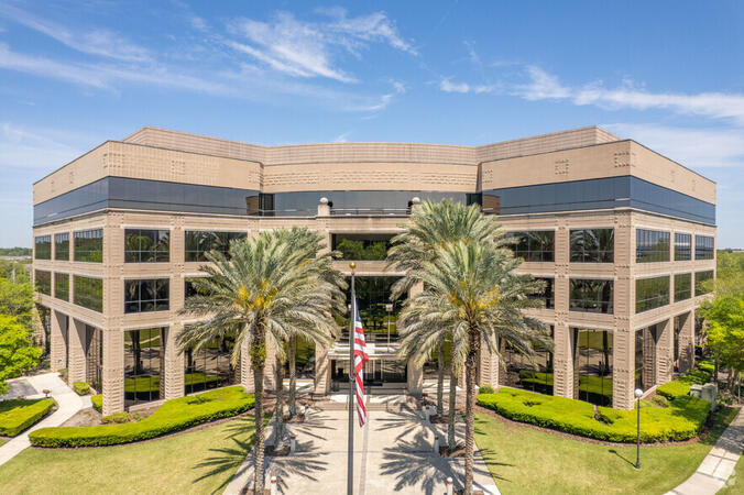
Jacksonville, FL – Deerwood Park
10151 Deerwood Park Blvd 200, Suite 250, Jacksonville, United States, 32256
The venue is nestled in the Deerwood Park campus at 10151 Deerwood Park Boulevard, just off J. Turner Butler Boulevard (JTB) and I‑295, with free on-site parking and adjacent lots. From Jacksonville International Airport (JAX), approximately 18 miles north, a taxi or rideshare takes about 25 minutes via I‑95 South and JTB West. Public transit is available via Jacksonville’s JTA bus routes stopping within walking distance, making the landscaped campus—complete with fountains, cafes, and scenic walkways—easily accessible for attendees without a car.
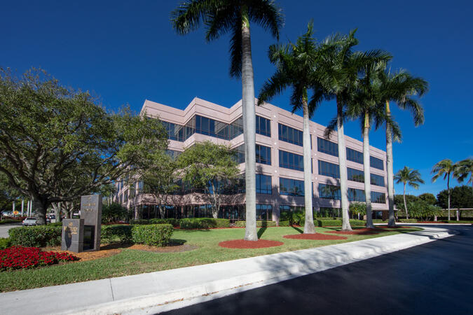
Miami, FL – Regus at Waterford at Blue Lagoon
6303 Blue Lagoon Drive, Suite 400, Miami, United States, 33126
The venue is set within the Waterford business park at 6303 Blue Lagoon Drive, just minutes from Miami International Airport. It’s accessible by car via I‑95, Florida Turnpike, 826, or Dolphin Expressway, with abundant covered and surface parking on-site. From Miami International Airport (MIA), a taxi or rideshare takes approximately 10 minutes via the Dolphin Expressway. Public transit options include TheBus routes and nearby Tri-Rail stations, with the property a short walk from bus stops—making it convenient even for attendees without a car.
Tampa, FL – Regus at Wells Fargo Center
100 S. Ashley Drive, Suite 600, Tampa, United States, 33602
The venue is located in the 22-story Wells Fargo Center in downtown Tampa, easily accessible by car via I‑275, I‑4, I‑75, or the Selmon Expressway, with covered garage parking (610+ spaces) directly connected to the building. From Tampa International Airport (TPA), a taxi or rideshare takes about 15 minutes via I‑275 East and Ashley Drive. Public transit is excellent with the Downtown Tampa Station (NFTA Metro Rail) just a block away and several bus routes running along Ashley and Brorein Streets, making it ideal for attendees arriving without cars.
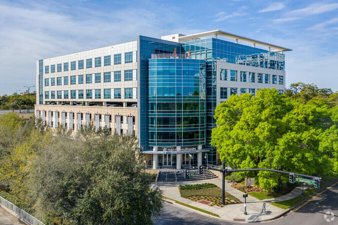
FL, Orlando – GAI Building
618 E. South Street Suite 500, Orlando, United States, 32801
The venue is located in the GAI Building with the CNS Healthcare logo at the front.
FL, Jacksonville - Bank of America Tower
50 N. Laura Street Suite 2500, Jacksonville, United States, 32202
The office is located in a premier office tower in Downtown Jacksonville on the 42nd floor. This Class A LEED Certified building is situated in the Northbank Office Market Preeminent location that provides commanding views. Downtown Trolley and Bus stops are located just across the street on Forsyth with easy access to I-95 leading to I-10 and I-295. Convenient to Jacksonville International Airport, the building is also just minutes to Everbank Field, Jacksonville Landing, Times Union Performing Arts Center, Jacksonville Veterans Memorial Arena and Jacksonville Public Library. Spectacular views of the St John's River in Jacksonville, Florida are one of many features that make the Bank of America Tower office space stand out. The office space occupies a blue granite tower in the heart of the city's central business district. The iconic tower is one of the best-known business premises in the southeastern United States and includes a statement lobby and class-A workspace. Businesses of all kinds appreciate Jacksonville's location at the crossroads of three major railroads and three interstates, and its international airport.
FL, Tallahassee – Alliance Center
113 South Monroe Street 1st Floor, Tallahassee, united states, 32301
The venue is located in the Alliance Center across the street from FUBA and the Florida Optometric Association.
FL, West Palm Beach - Philips Point
777 South Flagler Drive, West Palm Beach, United States, 33401
The venue is located in the Philips Point building just off the Royal Park Bridge.
FL, Aventura - Corporate Center
20801 Biscayne Blvd., Miami, united states, 33180
The venue is located in the Grove Bank & Trust building just off Biscayne Blvd.
FL, Fort Lauderdale - Corporate Center
Corporate Center, 110 East Broward Blvd., Fort Lauderdale, United States, 33301
The venue is located in the Corporate Center across the street from the Uniform Advantage Corporate Office and just next door to Colliers International.
Miami Beach, FL – Regus at Meridian Center
1688 Meridian Avenue, Suites 600/700, Miami Beach, United States, 33139
The venue is located on the corner of Meridian Avenue and 17th Street in Miami Beach’s vibrant City Center district, accessible by car via I‑195 and the MacArthur Causeway with underground and street parking nearby. From Miami International Airport (MIA), taxis or rideshares typically take 15–20 minutes via I‑195 East and Biscayne Boulevard. Public transit is seamless: several Metrobus routes serve Meridian Avenue, and the nearby 17th Street trolley stop makes it easy to reach without a car. The central location places the venue steps from the Miami Beach Convention Center, Lincoln Road Mall, restaurants, galleries, and retail.
Tampa, FL - Regus - One Urban Centre at Westshore
4830 W Kennedy Blvd #600, Tampa, United States, 33609
The venue is located in the Westshore business district at 4830 West Kennedy Boulevard, seamlessly accessible by car via I‑275 or I‑75 with secure underground and surface parking on-site. From Tampa International Airport (TPA), take Memorial Highway to I‑275 South and exit at West Kennedy Boulevard—taxi or rideshare typically takes about 15–20 minutes. Public transit users can reach the venue via HART bus routes (such as Route 2 or 32) stopping nearby, followed by a short walk into the building lobby.
This instructor-led, live training (available online or onsite) is designed for intermediate-level data scientists and engineers who wish to utilize Google Colab and Apache Spark for big data processing and analytics.
By the end of this training, participants will be able to:
- Configure a big data environment using Google Colab and Apache Spark.
- Efficiently process and analyze large datasets with Apache Spark.
- Visualize big data in a collaborative setting.
- Integrate Apache Spark with cloud-based tools for government.
Stratio is a data-centric platform that integrates big data, AI, and governance into a single solution. Its Rocket and Intelligence modules facilitate rapid data exploration, transformation, and advanced analytics in enterprise environments.
This instructor-led, live training (online or onsite) is designed for intermediate-level data professionals who aim to effectively utilize the Rocket and Intelligence modules in Stratio with PySpark, focusing on looping structures, user-defined functions, and advanced data logic.
By the end of this training, participants will be able to:
- Navigate and work within the Stratio platform using the Rocket and Intelligence modules.
- Apply PySpark for data ingestion, transformation, and analysis.
- Use loops and conditional logic to control data workflows and feature engineering tasks.
- Create and manage user-defined functions (UDFs) for reusable data operations in PySpark.
**Format of the Course**
- Interactive lecture and discussion.
- Extensive exercises and practice sessions.
- Hands-on implementation in a live-lab environment.
**Course Customization Options for Government**
To request a customized training for this course, please contact us to arrange.
Making Data-Informed Decisions is the practice of integrating relevant data, evidence, and analysis into the decision-making process to enhance public sector outcomes and accountability.
This instructor-led, live training (online or onsite) is designed for public sector professionals with limited or emerging experience in using data for decision-making. It is tailored for those who design, evaluate, or manage government programs and wish to improve their ability to interpret, validate, and apply data to real-world decisions.
By the end of this training, participants will be able to:
Understand the distinction between being data-informed (versus data-driven or intuition-based).
Identify and assess data relevant to a policy or service context.
Formulate more effective questions for data analysts and interpret dashboards and reports accurately.
Utilize data to justify, refine, or defend decisions in public service contexts.
Format of the Course
Interactive lectures and discussions.
Hands-on exercises using decision scenarios, data sets, and mock policy briefs.
Guided activities focused on practical decision-making use cases.
Course Customization Options
To request a customized training for government based on your department's workflows or internal tools, please contact us to arrange.
This instructor-led, live training in [location] (online or onsite) is aimed at intermediate-level data professionals who wish to apply time series forecasting techniques to real-world data using Google Colab for government.
By the end of this training, participants will be able to:
- Understand the fundamentals of time series analysis.
- Use Google Colab to work with time series data.
- Apply ARIMA models to forecast data trends.
- Utilize Facebook’s Prophet library for flexible forecasting.
- Visualize time series data and forecasting results.
Digital Intelligence is the capability to understand and utilize digital tools, data, and systems to make informed decisions in the context of public service delivery and governance.
This instructor-led, live training (available online or onsite) is designed for government professionals with limited or emerging experience in digital intelligence who work with data, digital tools, or service performance metrics and wish to enhance their ability to analyze, interpret, and apply information for better decision-making.
By the end of this training, participants will be able to:
Grasp the fundamentals of digital intelligence and its application in public sector work.
Utilize digital tools to gather, visualize, and communicate actionable insights.
Evaluate the digital maturity of their team or department.
Create a roadmap for improving digital capacity and data-driven practices.
Format of the Course
Interactive lecture and discussion.
Practical use of digital tools and dashboard mockups.
Guided exercises centered on real-world public service scenarios.
Course Customization Options
To request a customized training for government based on your department's workflows or internal tools, please contact us to arrange.
Storytelling with Data is the practice of using visual and narrative techniques to transform complex datasets into clear, compelling stories that inform and inspire action.
This instructor-led, live training (online or onsite) is designed for public sector professionals who work with data and have limited or informal training in data storytelling. The goal is to enhance their ability to present data clearly and persuasively through narrative and visuals for government applications.
By the end of this training, participants will be able to:
Transform raw data into impactful visual stories.
Use chart selection and layout to support key messages.
Structure data narratives that align with audience needs.
Apply best practices for visual clarity and cognitive impact.
Format of the Course
Interactive lecture and discussion.
Hands-on use of storytelling techniques in data presentations.
Guided exercises focused on clarity, visual flow, and audience impact.
Course Customization Options
To request a customized training for this course based on your department's workflows or internal tools, please contact us to arrange.
Participants who complete this instructor-led, live training in [location] will gain a practical, real-world understanding of Big Data and its related technologies, methodologies, and tools for government use.
The course provides opportunities for participants to apply this knowledge through hands-on exercises. Group interaction and instructor feedback are integral components of the class.
The curriculum begins with an introduction to fundamental concepts of Big Data, then progresses to the programming languages and methodologies used in data analysis. Finally, we explore the tools and infrastructure that enable Big Data storage, distributed processing, and scalability for government applications.
ArcGIS Professional Plus is an advanced version of ArcGIS Pro, designed to provide enhanced capabilities for geospatial data analysis, 3D modeling, automation, and enterprise collaboration.
This instructor-led, live training (available online or on-site) is tailored for intermediate-level GIS professionals who aim to deepen their expertise in spatial data analysis, automation, and sharing using the tools provided by ArcGIS Professional Plus.
By the end of this training, participants will be able to:
- Utilize ArcGIS Pro Plus tools for advanced data visualization and analysis.
- Develop 2D and 3D maps with sophisticated symbology and geoprocessing techniques.
- Automate workflows through the use of ModelBuilder and Python scripting.
- Integrate ArcGIS with external data services and enterprise systems.
**Format of the Course**
- Interactive lectures and discussions.
- Extensive exercises and practice sessions.
- Hands-on implementation in a live-lab environment.
**Course Customization Options for Government**
- To request a customized training program tailored to specific needs, please contact us to arrange.
This instructor-led, live training in [location] (online or onsite) is aimed at beginner-level data engineers, analysts, and scientists who wish to understand how to use dbt Cloud for managing their data warehousing and transformation projects in the cloud.
By the end of this training, participants will be able to:
- Create and manage projects on dbt Cloud.
- Utilize the dbt Cloud interface to schedule and execute data transformations.
- Collaborate effectively with team members on projects.
- Deploy dbt projects to a production environment.
- Debug and troubleshoot issues within dbt projects.
This training is designed to enhance the skills of government employees and contractors for government, ensuring they can efficiently manage data warehousing and transformation tasks.
This instructor-led, live training in [location] (online or onsite) is designed for government GIS professionals and analysts at all levels who wish to effectively use ArcGIS for data visualization, spatial analysis, and geospatial project management.
By the end of this training, participants will be able to:
- Navigate and utilize ArcGIS tools for geospatial data management.
- Create and customize maps with layers and attributes.
- Perform advanced spatial analysis and geoprocessing tasks.
- Automate workflows using ModelBuilder and Python for government applications.
This instructor-led, live training in [location] (online or onsite) is designed for advanced-level GIS professionals who wish to utilize ArcGIS Pro to enhance their spatial analysis capabilities, conduct comprehensive geostatistical analysis, and apply advanced 3D modeling techniques for more effective decision-making and problem-solving in real-world scenarios.
By the end of this training, participants will be able to:
- Develop advanced skills in spatial analysis techniques using ArcGIS Pro.
- Utilize Python scripting for automation and complex data processing tasks.
- Apply spatial modeling to address real-world challenges.
- Conduct geostatistical analysis for advanced data interpretation.
- Integrate external data sources and leverage 3D spatial data analysis, ensuring alignment with the specific needs of public sector workflows for government.
This instructor-led, live training in [location] (online or onsite) is designed for government and beginner to intermediate-level data analysts and business professionals who wish to perform complex data analysis tasks more intuitively using Google Gemini AI across various sectors.
By the end of this training, participants will be able to:
- Understand the fundamentals of Google Gemini AI.
- Connect various data sources to Gemini AI.
- Explore data using natural language queries.
- Analyze data patterns and derive actionable insights.
- Create compelling data visualizations for government use.
- Communicate data-driven insights effectively.
This instructor-led, live training in [location] (online or onsite) is designed for government data analysts and individuals interested in learning how to use and integrate Tableau, Python, R, and SQL for data visualization and analysis.
By the end of this training, participants will be able to:
- Conduct data analysis using Python, R, and SQL.
- Generate insights through data visualization with Tableau.
- Make data-driven decisions to enhance business operations for government.
This instructor-led, live training in Florida (online or onsite) is designed for beginner-level IT support personnel who aim to provide robust support for ArcGIS Enterprise, effectively addressing any anomalies or failures.
By the end of this training, participants will be able to:
- Understand the architecture and components of ArcGIS Enterprise.
- Learn how to install, configure, and manage ArcGIS Enterprise.
- Acquire skills in troubleshooting and resolving common issues.
- Develop proficiency in monitoring and maintaining ArcGIS Enterprise environments.
- Master techniques for backup, recovery, and performance optimization, ensuring reliable service delivery for government operations.
This instructor-led, live training in Florida (online or onsite) is designed to assist participants in preparing for the Microsoft Certified: Data Scientist Associate certification exam (DP-100).
The course provides an overview of data science fundamentals and machine learning techniques, with a focus on their implementation using Microsoft Azure Machine Learning. Participants will gain hands-on experience in data preparation, building and training machine learning models, and deploying these models to the cloud. Additionally, the course covers methods for evaluating model performance and conducting feature engineering, ensuring that participants are well-prepared for practical applications in various sectors, including those for government.
This instructor-led, live training in Florida (online or onsite) is designed for intermediate-level data engineers who aim to become proficient in leveraging Azure Synapse Analytics for a variety of data processing, analytics, and visualization tasks.
By the end of this training, participants will be able to:
Comprehend the fundamental concepts, architecture, and components of Azure Synapse Analytics.
Establish, configure, and manage scalable data warehouses using Azure Synapse.
Acquire expertise in ingesting, transforming, and loading data (ETL) from diverse sources into Azure Synapse.
Enhance query performance, ensure data security, and integrate Azure Synapse with Power BI and other tools to visualize data and disseminate insights effectively for government use cases.
This instructor-led, live training in [location] (online or onsite) is designed for government professionals at the beginner level who wish to learn the fundamental concepts and tools of ArcGIS.
By the end of this training, participants will be able to:
- Understand the basic principles of Geographic Information Systems (GIS) and spatial data.
- Navigate the ArcGIS interface effectively.
- Create and manage spatial datasets.
- Conduct basic spatial analysis.
- Produce maps and visualizations for government use.
This instructor-led, live training (online or onsite) is designed for government earth sciences and engineering professionals at the beginner level who wish to utilize Python for geospatial analysis in both ArcGIS and QGIS environments.
By the end of this training, participants will be able to:
Master Python syntax and control structures to efficiently execute geospatial tasks.
Utilize Pandas, Numpy, and Matplotlib for data analysis and visualization in GIS applications.
Manage and analyze vector data using Geopandas, Arcpy, and PyQGIS libraries.
Automate geospatial processes and workflows through Python scripting in ArcGIS and QGIS.
Create custom Python-based geoprocessing tools for ArcGIS and QGIS to enhance task efficiency.
Big Data and Advanced Analytics involves the application of sophisticated techniques and tools to analyze large, complex datasets, providing actionable insights and strategic decision-making capabilities.
This instructor-led, live training (available online or onsite) is designed for advanced-level data professionals who aim to leverage cutting-edge analytical methods and big data technologies for predictive, prescriptive, and real-time analytics in government and other sectors.
By the end of this training, participants will be able to:
- Design and implement large-scale data processing pipelines for both structured and unstructured data.
- Apply advanced machine learning and deep learning techniques to massive datasets.
- Utilize distributed computing frameworks for real-time analytics and data streaming.
- Integrate big data analytics into business intelligence and decision-making systems for government.
**Format of the Course**
- Interactive lectures and discussions
- Extensive exercises and practice sessions
- Hands-on implementation in a live-lab environment
**Course Customization Options**
- To request a customized training program for this course, please contact us to arrange.
The objective of the course is to assist participants in providing evidence-based responses to key questions:
### What Has Happened?
- Processing and analyzing data
- Creating informative data visualizations
### What Will Happen?
- Forecasting future performance
- Evaluating forecasts
### What Should Happen?
- Converting data into evidence-based decisions for government
- Optimizing processes
This instructor-led, live training in [location] (online or onsite) is designed for intermediate-level geographers who wish to enhance their expertise in spatial analysis, data management, and GIS applications for government.
By the end of this training, participants will be able to:
- Apply advanced spatial analysis techniques to address complex geographical challenges.
- Manage large spatial databases and conduct thorough data quality control.
- Create dynamic and interactive maps and visualizations for a variety of applications.
- Utilize programming and automation to optimize GIS workflows for government.
Insurance in the Digital Era is an applied overview of how digital transformation reshapes products, operations, and customer engagement within the insurance industry.
This instructor-led, live training (available online or on-site) is designed for intermediate-level insurance professionals who seek to understand and apply digital technologies, data-driven strategies, and innovation frameworks to modernize insurance offerings and operations for government and private sector use.
By the end of this training, participants will be able to:
- Explain the role of AI, Big Data, IoT, and automation in modern insurance workflows.
- Identify InsurTech trends and their impact on the insurance ecosystem.
- Design customer-centric strategies enabled by digital tools and data insights.
- Apply data-driven approaches to risk management and decision-making.
- Develop an innovation and change management approach suitable for insurers.
- Assess real-world case studies and translate lessons into local initiatives.
**Format of the Course**
- Interactive lecture and discussion.
- Case study analysis and group workshops.
- Practical exercises and action planning for participants’ organizations.
**Course Customization Options**
- To request a customized training for this course, please contact us to arrange.
R is a widely used, open-source environment for statistical computing, data analytics, and graphical representation. This course introduces the R programming language to participants, covering language fundamentals, libraries, and advanced concepts. It includes advanced data analytics and graphing techniques using real-world data.
Data analytics is a critical tool in the public sector today. This course will focus on developing practical, hands-on skills for government data analysis. The aim is to equip participants with the ability to provide evidence-based answers to key questions:
What has happened?
processing and analyzing data
creating informative data visualizations
What will happen?
forecasting future performance for government operations
evaluating the accuracy of forecasts
What should happen?
transforming data into evidence-based decisions for government
This instructor-led, live training in Florida (online or onsite) is aimed at intermediate-level Python developers and data analysts who wish to enhance their skills in data analysis and manipulation using Pandas and NumPy for government applications.
By the end of this training, participants will be able to:
Set up a development environment that includes Python, Pandas, and NumPy.
Create a data analysis application using Pandas and NumPy for government workflows.
Perform advanced data wrangling, sorting, and filtering operations.
Conduct aggregate operations and analyze time series data.
Visualize data using Matplotlib and other visualization libraries.
Debug and optimize their data analysis code to ensure compliance with public sector governance standards.
This instructor-led, live training in Florida (online or onsite) is designed for government developers and administrators who wish to utilize OpenSearch to conduct distributed search and data analytics within a unified and secure system.
By the end of this training, participants will be able to:
- Set up the required development environment to begin building search and analytics solutions with OpenSearch and OpenSearch Dashboards.
- Understand the three methods (snapshot, restart, and rolling) for upgrading from Elasticsearch OSS to OpenSearch.
- Learn how to index data, create data streams, execute queries, and manage cross-cluster operations in OpenSearch.
- Explore and utilize plugins, APIs, clients, and ingestion tools (such as Beats, Logstash, Grafana, etc.) to enhance the search experience while maintaining secure clusters.
- Use OpenSearch Dashboards to centralize data management, visualization, logging, monitoring, and maintenance for government applications.
This instructor-led, live training (online or onsite) is designed for individuals who wish to acquire sufficient Python skills to effectively analyze and interpret data from various sources, such as sales records, traffic analytics, and customer interactions.
By the end of this training, participants will be able to:
Install and configure the required software, libraries, and development environment necessary for writing Python code for data analysis.
Analyze data from diverse sources, including Excel spreadsheets, CSV files, JSON documents, and databases.
Clean and preprocess data to enhance its quality and usability before performing analysis.
Conduct basic statistical analyses to derive meaningful insights.
Create reports that present data in a clear and actionable format, ranging from numerical summaries to visualizations.
Extract valuable insights from data, including performance trends and areas requiring attention.
This training is tailored to support the unique needs of public sector workflows, ensuring alignment with governance and accountability standards for government.
This instructor-led, live training (online or onsite) is aimed at software developers, managers, and business analysts who wish to use big data systems to store and retrieve large amounts of data for government purposes.
By the end of this training, participants will be able to:
Efficiently query large datasets.
Understand how big data systems manage data storage and retrieval.
Leverage the latest big data systems available for government use.
Transform data from various systems into reporting formats.
Learn to write SQL queries in:
MySQL
Postgres
Hive Query Language (HiveQL/HQL)
Redshift
Format of the Course
Interactive lecture and discussion.
Extensive exercises and practical activities.
Hands-on implementation in a live-lab environment.
Course Customization Options
To request a customized training for government-specific needs, please contact us to arrange.
The objective of this course is to provide a comprehensive understanding of using SQL for various databases, including Oracle, SQL Server, and MS Access. Participants will gain insight into analytic functions and the techniques for joining different tables within a database. This knowledge will enable them to shift data analysis tasks to the database level, rather than relying on applications like MS Excel. Such skills are essential for developing any IT system that utilizes relational databases, particularly for government operations where efficiency and data integrity are paramount.
This instructor-led, live training in Florida (online or onsite) is designed for intermediate-level business and IT professionals who aim to master the skills needed to write effective acceptance criteria for requirements.
By the end of this training, participants will be able to:
- Understand the significance of acceptance criteria.
- Develop and validate requirements acceptance criteria.
- Utilize various methods for articulating acceptance criteria.
- Ensure the quality of analytical artifacts for government use.
This instructor-led, live training in Florida (online or onsite) is designed for government business analysts who wish to learn advanced Spotfire Analyst techniques for data analysis.
By the end of this training, participants will be able to:
Share visualizations among team members to enhance collaboration and decision-making processes.
Implement role-based access controls to secure software usage in accordance with government policies.
Create specialized visualizations, including map charts, to better represent data for government reporting.
Integrate statistical computing languages such as R with Spotfire to leverage advanced analytics capabilities for government projects.
This instructor-led, live training (conducted online or onsite) is designed for field ecologists and conservation managers who aim to develop spatial data projects using ArcGIS.
By the end of this training, participants will be able to:
- Generate visualizations from spatial data.
- Perform geostatistical analyses on real-world datasets.
- Execute spatial data analysis, data processing, and mapping with ArcGIS.
- Analyze spatial data for various projects in ArcGIS, ensuring alignment with public sector workflows and governance standards for government.
This course focuses on the application of data analytic techniques and methodologies to address challenges in government operations using R, Python, and SQL. It highlights the alignment of governmental requirements with data analytics, treating these tools as essential resources for addressing queries and issues for government.
Professionals in decision-making roles, including managers and executives, who are looking to leverage data for informed decisions. Data specialists, marketing professionals, and business consultants aiming to enhance their data interpretation and storytelling skills for government and other public sector applications.
This curriculum provides a comprehensive, experiential learning environment for government personnel engaged in data-driven operations. The program is designed to equip federal employees with the technical proficiency required to analyze business datasets, derive actionable intelligence, and enhance strategic decision-making processes. Delivered through live, instructor-led sessions available via secure virtual platforms or at designated facilities, this training targets professionals at the foundational to intermediate stages of their analytical careers. Participants will gain competence in applying contemporary analytical methodologies and software tools to identify patterns, interpret complex information, and communicate findings effectively for government stakeholders and operational needs.
This instructor-led, live training in [location] (online or onsite) is designed for government data scientists, data analysts, and business analysts who aim to enhance their skills in effectively cleaning and processing data.
By the end of this training, participants will be able to:
- Develop a comprehensive data cleaning strategy.
- Utilize effective tools for data cleaning.
- Achieve results more efficiently.
- Learn and apply best practices in data cleaning for government.
This program is designed to enhance the strategic and operational capabilities of your team in identifying, evaluating, and fostering potential partnerships and acquisitions within the digital insurance sector. The primary objective is to equip your team with the skills necessary to drive the transformation and growth of your digital ecosystem for government.
In the rapidly evolving energy sector, the integration of electrical transient analysis with accurate geographic data is a strategic imperative for government agencies and utilities. The current reliance on fragmented data sources poses significant operational risks. This 14-day intensive program in Melbourne is designed to bridge the gap between electrical engineering and geospatial management, ensuring enhanced alignment with public sector workflows and governance for government operations.
This foundation-level course is designed for individuals involved in Requirements Engineering and Agile methodologies. It caters to professionals such as project or IT managers, domain experts, system analysts, software developers, Scrum Masters, Product Owners, and those who are part of Agile organizations.
RE@Agile draws inspiration from both IREB’s perspective on Agile values and an Agile viewpoint on Requirements Engineering values. The course content covers the classification and evaluation of Requirements Engineering work products and techniques within an Agile context, as well as Agile work products and techniques within a Requirements Engineering framework. It also addresses essential process elements in Agile product development and highlights the motivation for incorporating Agile into the development process.
A significant focus is on the synergy between Requirements Engineering and Agile: understanding Agile principles related to Requirements Engineering and the alignment of Agile mindset with core Requirements Engineering values.
### The Examination
This course serves as a foundation for the RE@Agile Primer examination. Two types of examinations are offered:
- **Proctored Multiple-Choice Examination**: This exam, similar in format to the CPRE Foundation Level and Advanced Level multiple-choice examinations, includes an official RE@Agile Primer certificate and lasts 40 minutes.
- **Online Multiple-Choice Self-Assessment**: This option provides a confirmation of participation and is suitable for self-evaluation.
These assessments are designed to ensure that participants gain a comprehensive understanding of the material and are well-prepared to apply their knowledge in real-world scenarios, particularly within government contexts.
The KNIME Analytics Platform is a premier open-source solution for data-driven innovation, enabling users to uncover the potential within their data, extract valuable insights, and forecast future trends. Featuring over 1,000 modules, hundreds of ready-to-run examples, an extensive array of integrated tools, and a broad selection of advanced algorithms, KNIME Analytics Platform is an indispensable resource for any data scientist or business analyst.
This training course for the KNIME Analytics Platform provides an excellent opportunity for beginners, advanced users, and KNIME experts to familiarize themselves with KNIME, enhance their usage proficiency, and create clear, comprehensive reports based on KNIME workflows.
This instructor-led, live training (online or onsite) is designed for data professionals who wish to leverage KNIME to address complex business challenges.
It is particularly suitable for individuals without a programming background who aim to use advanced tools to implement sophisticated analytics scenarios.
By the end of this training, participants will be able to:
Install and configure KNIME.
Develop data science scenarios.
Train, test, and validate models.
Implement the entire value chain of data science models.
Format of the Course
Interactive lectures and discussions.
Extensive exercises and practice sessions.
Hands-on implementation in a live-lab environment.
Course Customization Options
To request a customized training for government or to learn more about this program, please contact us to arrange.
The "KNIME Analytical Platform" training offers a comprehensive overview of this free data analysis platform. The program covers data processing and analysis introduction, KNIME installation and configuration, building workflows, business model creation methodology, and data modeling. The course also discusses advanced data analysis tools, workflow import and export, tool integration, ETL processes, data exploration, visualization, extensions, and integrations with tools such as R, Java, Python, Gephi, Neo4j. The conclusion includes a discussion on reporting, BIRT integration, and the KNIME WebPortal.
This instructor-led, live training in Florida (online or onsite) is aimed at data scientists who wish to program in Python and R for KNIME for government applications.
By the end of this training, participants will be able to:
Plan, build, and deploy machine learning models in KNIME for government projects.
Make data-driven decisions for operational improvements.
Implement end-to-end data science projects within public sector workflows.
This instructor-led, live online training is designed for advanced learners who wish to develop skills in managing large-scale spatial databases using PostGIS and QGIS.
**Format of the Course**
- Interactive lectures and discussions.
- Extensive exercises and practice sessions.
- Hands-on implementation in a live-lab environment.
**Course Customization Options**
- To request a customized training for government or other specific needs, please contact us to arrange.
As your delegates prepare for advanced Data Analytics degrees abroad, they will encounter a dual challenge: mastering the technical aspects of coding and learning to translate data insights into actionable business value. This comprehensive 5.5-hour program is designed to address both challenges concurrently. By integrating foundational Python programming skills with an introductory framework in business analytics, we ensure that your team begins their academic journey as leaders, not just learners, prepared to meet the demands required for government and private sector success.
A geographic information system (GIS) is designed to capture, store, manipulate, analyze, manage, and present spatial or geographic data. The term GIS is sometimes used interchangeably with geographic information science (GIScience), which refers to the academic discipline that studies these systems and is a significant domain within the broader field of geoinformatics.
QGIS functions as geographic information system (GIS) software, enabling users to analyze and edit spatial information, as well as compose and export graphical maps. QGIS supports both raster and vector layers; vector data can be stored as point, line, or polygon features. The software accommodates multiple formats of raster images and can georeference these images. In summary, QGIS allows users to create, edit, visualize, analyze, and publish geospatial information on Windows, Mac, Linux, and BSD.
This program, in its first phase, introduces the QGIS interface for general usage. In the second phase, it covers PyQGIS—the Python libraries of QGIS that enable the integration of GIS functionalities into Python code or applications. This allows users to develop their own Python plugins around specific GIS functionalities, enhancing capabilities for government and other sectors.
A Geographic Information System (GIS) is designed to capture, store, manipulate, analyze, manage, and present spatial or geographic data. The term GIS is also used to refer to the academic discipline of geographic information science (GIScience), which studies these systems and is a significant domain within the broader field of geoinformatics.
This instructor-led, live training (online) is intended for government employees at a beginner level who wish to gain knowledge on GIS concepts and practical skills for using QGIS.
**Format of the Course**
- Interactive lecture and discussion.
- Extensive exercises and practice sessions.
- Hands-on implementation in a live-lab environment.
**Course Customization Options**
- To request a customized training for government, please contact us to arrange.
This instructor-led, live online training at an intermediate level is designed to teach participants how to work with satellite imagery and perform image classification using QGIS.
**Format of the Course**
- Interactive lecture and discussion.
- Extensive exercises and practice sessions.
- Hands-on implementation in a live-lab environment.
**Course Customization Options for Government**
To request a customized training for this course, please contact us to arrange.
Snowflake operates as a cloud-native data platform that provides robust capabilities for the processing and analysis of large-scale datasets. Designed as a Software-as-a-Service (SaaS) solution, it integrates the scalability and flexibility of cloud infrastructure with the performance standards of an advanced enterprise data warehouse. The system is particularly valued for its utility for government agencies requiring secure, scalable, and efficient data management.
Key technical attributes include:
* **Cloud-Native Architecture**: Built exclusively for the cloud, this architecture ensures high performance and elastic scalability of storage and compute resources to meet fluctuating workload demands.
* **Decoupled Storage and Compute**: The platform’s unique design isolates storage workloads from compute workloads, enabling independent scaling and optimization of each component to enhance efficiency.
* **Support for Multi-Format Data**: Snowflake accommodates the storage and analysis of diverse data types, including structured, semi-structured (such as JSON and XML), and unstructured formats.
* **Optimized Query Performance**: The system delivers rapid query processing through automatic optimization techniques, facilitating efficient execution of complex analytical workloads on extensive datasets.
* **Comprehensive Security Governance**: Advanced security protocols are embedded within the platform, featuring data encryption at rest and in transit, role-based access controls, and detailed audit logging to ensure compliance and accountability.
* **Seamless Ecosystem Integration**: The platform integrates readily with existing Enterprise Information Technology (EIT) systems, Business Intelligence (BI) tools, and Extract, Transform, Load (ETL) services, supporting the development of cohesive analytical solutions.
* **Usage-Based Pricing Model**: A consumption-based payment structure allows organizations to optimize costs by paying only for the resources utilized, providing financial flexibility and scalability.
* **Broad Applicability**: The platform supports a wide range of use cases, from standard business intelligence reporting to complex data engineering, big data analytics, and machine learning initiatives.
Due to its adaptability, performance efficiency, ease of deployment, and alignment with diverse technological requirements, Snowflake is a preferred solution for organizations of varying sizes seeking to modernize their data infrastructure.
This instructor-led, live training in Florida (online or onsite) is designed for business analysts and data analysts who wish to utilize TIBCO Spotfire X with its artificial intelligence capabilities to visualize, transform, and analyze data for government.
By the end of this training, participants will be able to:
- Install and configure TIBCO Spotfire X.
- Understand the features and architecture of TIBCO Spotfire X.
- Grasp the concepts behind augmented and predictive analytics.
- Learn how to load, process, and visualize data using Spotfire X.
- Create interactive and enhanced data visualizations for government.
This instructor-led, live training in Florida (online or onsite) is designed for government and business professionals who aim to utilize data storytelling, PowerPoint, and AI tools to create executive presentations that support informed decision-making and adhere to corporate branding standards.
By the end of this training, participants will be able to structure messages using AI, enhance slide design, strengthen visual narratives, and deliver more effective and clear executive presentations for government and other organizational contexts.
This Training Needs Analysis course is designed to provide participants with a comprehensive overview of best practices, tools, and techniques for delivering a world-class training function for government. Attendees will receive a full suite of resources and case studies that can be readily implemented in their workplaces, ensuring alignment with public sector workflows, governance, and accountability.
Read more...
Last Updated:
Testimonials (11)
The basic structure of Power BI, its main functions, as well as some advanced functions
Alessandro Binaghi - Great Place to Work(R) Institute Italia Srl
Course - PL-300: Microsoft Power BI Data Analyst
Practical and hands on labs on report developmemt using Power BI
The labs were excellent and the trainer offered very good hands on sessions
Sinzala Sichaanji - Bank of Zambia
Course - Mastering Power Platform: Power Apps, Power Automate, DataVerse, Power BI, and Power Virtual Agents
personalised to our understanding and data
Vincent Long - ASSMANG PTY LTD
Course - Business Intelligence with SSAS
engagement with the attendees
Magdeline Matsie Mokonyane-Motha - Tshwane University of Technology
Course - PL-300T00: Microsoft Power BI Data Analyst
Practice in using python is really helpful to understand the basics.
Wildana Ramadhani - OJK
Course - Foundations of Data & Business Analytics
the practical part
Daniela Mirevska
Course - Business Process Modelling in BPMN 2.0
We did quite complex examples, so we could get a feeling of how the real work with Power Automate Desktop can look like in the real world scenario.
Michal Strnad - MicroNova AG
Course - Microsoft Flow/Power Automate
Smart work reporting criteria
Siyabonga Kubeka - NTCSA
Course - Power BI for Business Analysts
The teacher clarification of the teacher about the subjects
Josildo Zangue - EMIS - Empresa Interbancaria de Servicos, S.A
Course - Business Analysis
hands on exercise
shuzhen hong
Course - AI-Driven Data Analysis with TIBCO Spotfire X
The coding and analysis, how the information come together in a report which will be useful for my work
Nokuthula Dhludhlu - National Transmission Company South Africa
Online Data Analysis training in Florida, Data Analysis training courses in Florida, Weekend Data Analysis courses in Florida, Evening Data Analysis training in Florida, Data Analysis instructor-led in Florida, Evening Data Analysis courses in Florida, Data Analysis trainer in Florida, Data Analysis instructor-led in Florida, Data Analysis on-site in Florida, Data Analysis classes in Florida, Data Analysis boot camp in Florida, Data Analysis one on one training in Florida, Data Analysis coaching in Florida, Online Data Analysis training in Florida, Weekend Data Analysis training in Florida, Data Analysis instructor in Florida, Data Analysis private courses in Florida